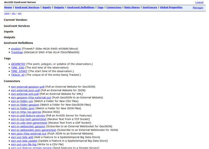
ArcGIS GeoEvent Server is a Java implementation of a collection of RESTful web services and resources. The ArcGIS GeoEvent Server administrative REST API allows you to automate the administration of GeoEvent Server. Client applications interact with GeoEvent Server through the administrative REST API.
GeoEvent Manager capabilities are entirely dependent on the GeoEvent Server REST API. All of the administrative tasks you can perform in GeoEvent Manager can be executed via an HTTP request to a REST endpoint exposed through the GeoEvent Server administrative REST API.
The endpoints provided by the REST API, which require client authentication using administrative user credentials, are part of the GeoEvent Server administrative REST API.
GeoEvent Server administrative REST API
The GeoEvent Server administrative REST API provides endpoints and resources such as access to connectors, data stores, and geofences.
Access the GeoEvent Server administrative REST API at https://gisserver.domain.com:6143/geoevent/admin/.

When accessing the GeoEvent Server administrative REST API for the first time, you must generate a token to authenticate with the GeoEvent Server administrative REST API.
When ArcGIS Server is federated as a portal hosting server, the page will instruct you to use the portal token service to acquire the token; otherwise, you will be instructed to use the ArcGIS Server token service. Once authenticated with the administrative REST API on the server, the additional endpoints will be available to client applications.