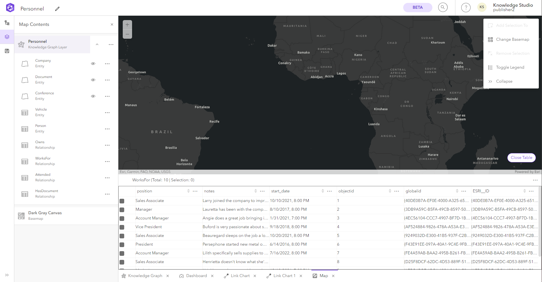
The entities and relationships added to a map can also be explored in the record table. Seeing a tabular view of the data can be a quick way to analyze information and start making decisions. You can sort the record data and hide fields to focus on specific records.
Open the table
You can display an interactive table at the bottom of a view to see information about features or records in a specific entity type or relationship type sublayer.
- Click Options
 next to the sublayer name in the Map Contents pane.
 - Click Open Table
 in the dropdown menu.
The table opens at the bottom of the view.

Explore the table
You can sort the data and fields to focus on the data you're interested in. You can also select rows in the table and zoom to the location of the extent of all the selected features on the map.
By default the table filters the records displayed based on the extent of the map. To see all records in the sublayer, toggle the Extent Filter off.
Sort the table
Sort the records in each field to make the data easier to view.
- There are three ways to sort the table.
- Click the up or down arrow for the field to sort values in ascending or descending order, respectively.
- Select the field, click Options
 , and click either Sort ascending or Sort descending.
 - Click a field name and drag it to a new place in the table to change the order of the fields.
This does not change the order of the fields stored in the table, only your view of the fields while in the map.
Hide fields
Table fields can be hidden to focus on specific record properties.
- Click Tools
 in the table header and uncheck the fields that you want to hide.
 - Optionally, click Tools
 in the table header and check the fields that you want to show (unhide) in the table.
Select records
Records selected in the table will also be selected on the map.
Note:
By default, the records in the table are filtered to the current extent of the map. You can turn off the Extent Filter to view and select all records.
- Click the checkbox at the start of each row to select the record.
By default, the records in the table are filtered to the current extent of the map. You can turn off the Extent Filter to see all records. You can also zoom to the extent of the selected records from the table.
You can clear the selected records by clicking anywhere on the map, or you can clear the selected records through the table options.
- Click Options
 in the table header.
 - Click Clear selection